Glenariff/ Ballyeamon Scenic Route
Length of Drive
19 miles / 31 kilometers
Route Description
19 miles / 31 kilometers
Route Description
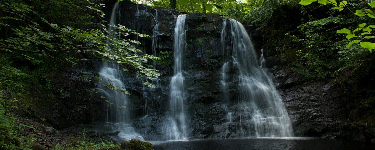
The is a two glen experience (Glenariff and Glenballyeamon) on a two way (lined) 'B' roads with winding sections through both glens. The route is signposted at Waterfoot and Cushendall, by taking the route you will lose two miles of the Causeway Coastal Route between Waterfoot and Cushendall. The waterfall walk and Glenariff Forest Park are beautiful and well worth a visit.
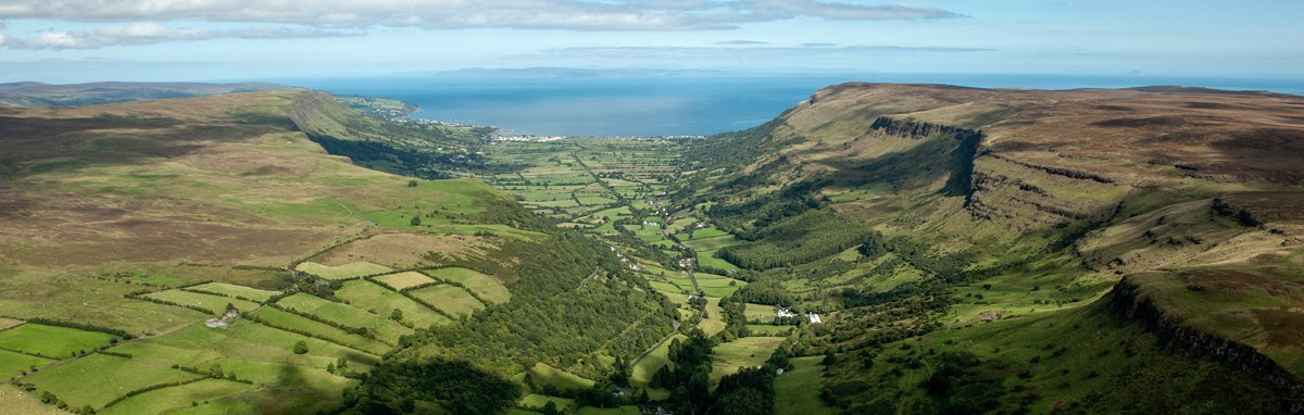
The two glens form the sides of Lurigethan mountain which overlooks Cushendall, taking the route from Waterfoot you climb up the side of Glenariff which has some stunning panoramas, it has been described as resembling a mini Switzerland. On the right as you get halfway up there are a couple of active roadside waterfalls just before you arrive at the turn off for Larragh Lodge, the access point to one of the most visited waterfalls in the glens. The parking area here is small and in summer gets overcrowded and congested, it is though one of the access points to the forest park and the nearest point to one of the main waterfalls. Further up the road is the main entrance to Glenariff Forest Park, it has a large car parking area where you pay to park.
Being at the top of the glen there are exceptional views and a choice of outstanding forest and river walks as well as a picnic site overlooking the glen. Glenariff is a U shaped valley cut by glacial activity some 10,000 years ago. The glen once had a narrow-gauge railway running down the side (right-hand side in the photo above) which took iron ore from mines on the plateau down through the glen toa pier by the shore for shipment. You pass between the remains of the white limestone bridge on the main Causeway Coastal Route, the old limestone engine house and workers cottages remain. This is just before you reach Waterfoot coming from Belfast, there is a layby and information panel nearby on the right-hand side and you will see the broken remains of a pier. At the top of Glenariff where you turn right to join the Glenballyeamon Scenic Route is the ruin of Parkmore Station.
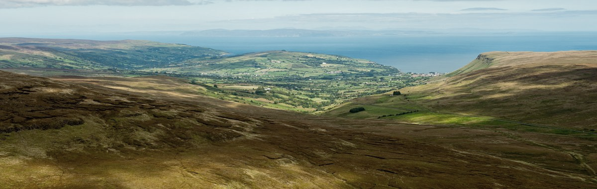
This was where visitors would arrive by train from Ballymena and then travel by horse and trap down to the Forest Park and on to Cushendall. Glenballyeamon has one of the highest viewpoints in the glens with panoramic views over Glenballyeamon and Glencorp, as well as to Trostan mountain, Glenaan and Scotland. The road descends the side of Lurig into Cushendall where it rejoins the Causeway Coastal Route. The highlights of these glens are the views, waterfalls, forests, fairy trees and if your lucky feral goats. Glenariff also has the 'classic' remains of ladder fields, this was how the landlord would divide the ground for tenant farmers so each would get an equal share of fertile ground in the valley to rocky land higher up.