Glens of Antrim

The Nine Glens Of Antrim

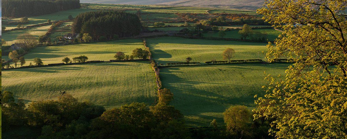
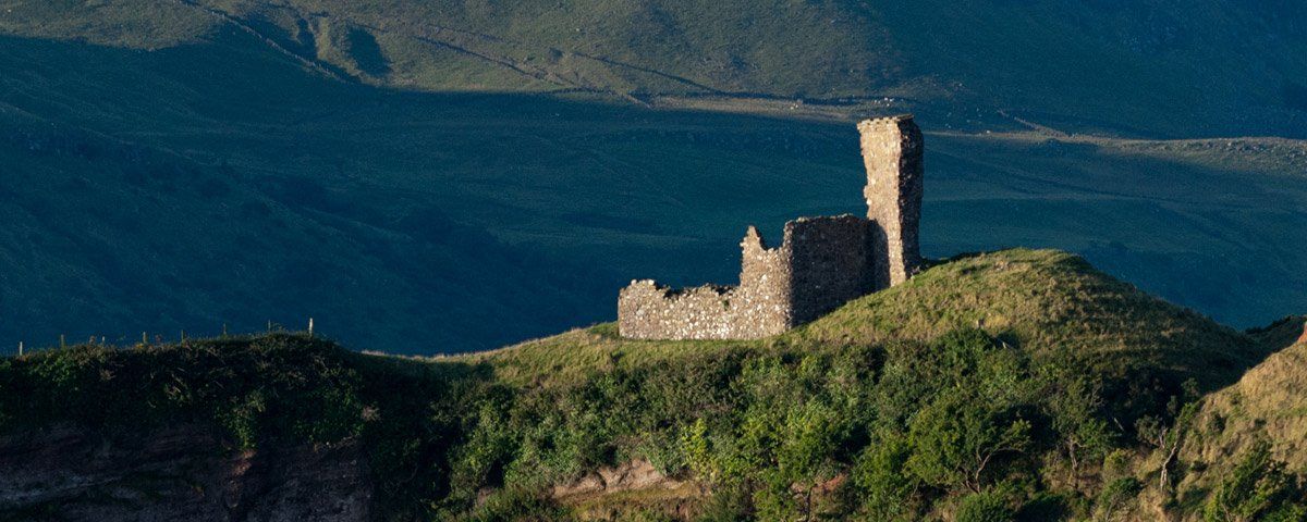
A synopsis of the Nine Glens of Antrim which was made famous in several songs for their beauty and unique ambience. Eight of these glens feature in four of the scenic loop drives off the Causeway Coastal Route and one, Glencorp, has the main route passing through its entire length. Please check back from time to time as information will be added as it is found on each glen.

Glenarm - Glen of the Army
Glenarm by Art Ward ©
Like all most of the nine glens, you will find a settlement located where the glen meets the ocean. Here we have the old and very characteristic village of Glenarm with Glenarm Castle and Demesne as the main focal point for the village. The glen has fabulous walks and panoramic views, five minutes from the village takes you into a wooded riverside walk. Across the river lies the castle estate and a walled garden which is also open to the public. The main identity of the glen is Glenarm Castle and Estate which has been the seat of the McDonnell clan since 1750, having moved here from Dunluce Castle and Ballymagarry House. The glen has several tombs, raths and ruins which chart settlement from the Neolithic period to the present day.
Glenarm by Art Ward ©

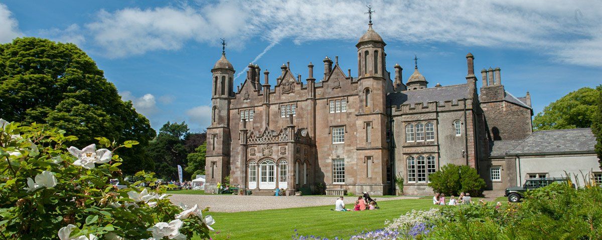
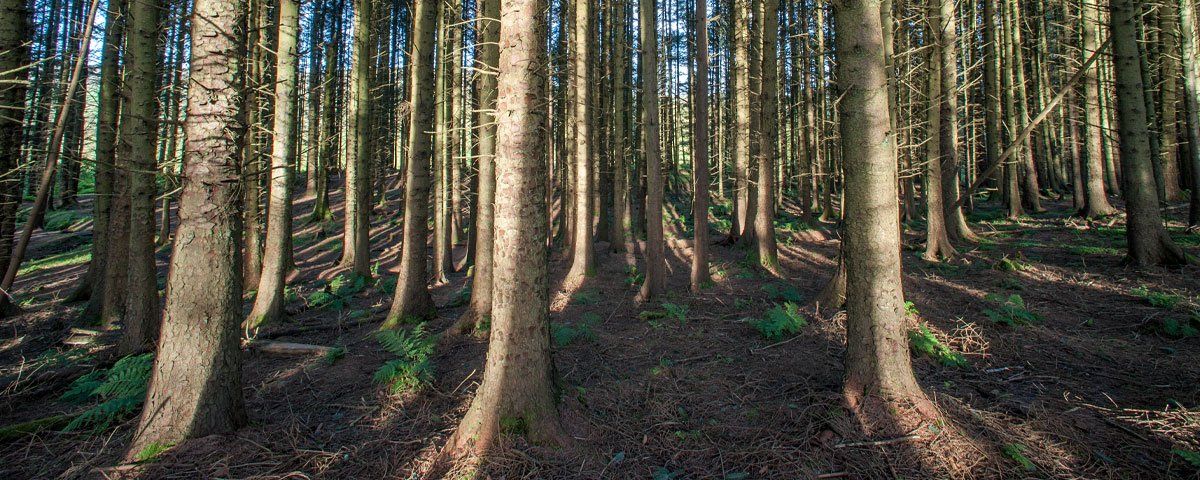
The accessibility of water in what was a densely forested landscape and the abundant deposits of flint, iron ore and limestone made the location attractive to early man. Excavations of one rath by the Department of the Environment shows occupation from 500 to 950AD. The Slemish Scenic Drive from Glenarm follows the glen up onto the Antrim plateau and Slemish mountain where St Patrick was held as a slave and where he returned to convert his ex master to Christianity.  At the front of Glenarm Castle are the remains of the ancient church of Templeoughter where it is said the body of Shane O'Neill was buried after he was slain near Cushendun by the McDonnells in 1567.

Glencloy- Glen of the Hedges
Photo of the Glens by Art Ward ©

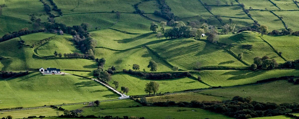
A large sweeping glen which was in the past know as Glenclew. The glen has been inhabited since Neolithic times due to the abundant resources. It provided the raw materials for flint weapon production from the surrounding limestone cliffs of what is a raised beach. The limestone later attracted the development of the limestone industries that in turn brought about the development of the beautiful limestone harbour and village of Carnlough which lies at the outflow of the glen. The limestone extracted from the quarry was transported down to the shore by a gravity-fed railway system, the weight of the loaded wagons going down would pull up the empty ones.

Photo of the Glens by Art Ward ©

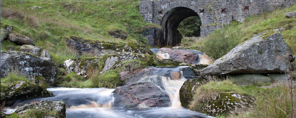
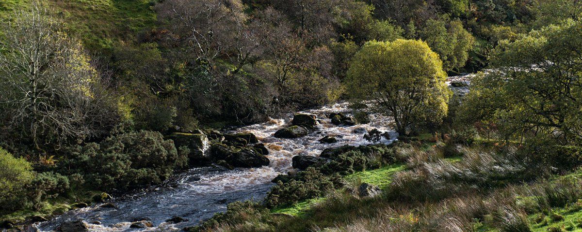
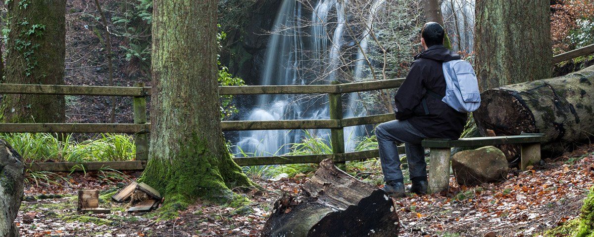
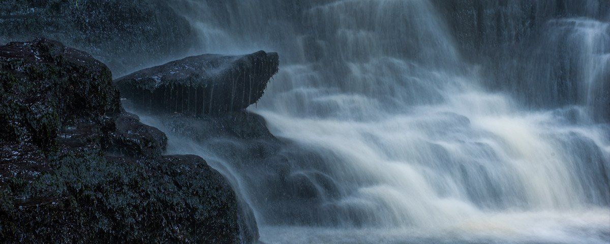
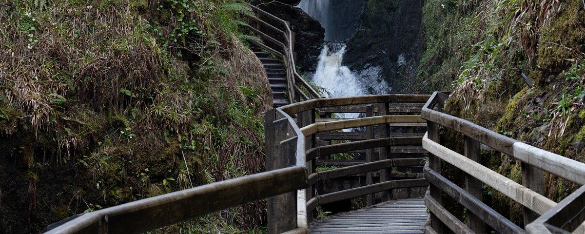
A walk up from the harbour over the limestone bridge and along the remains of the old mineral railway line will bring you to the site of what was once a hive of local industry which employed around one hundred and fifty men. Today the site is well recovered by nature and provides an excellent reserve for wildlife as well as excellent walk, it is also the site of Cranny Falls'. As you drive up the glen, about two miles out on the left you will see a layby, this is Doonan Leap which has a viewing platform overlooking Doonan waterfall. For some spectacular views back over Carnlough I recommend a walk up from the harbour along the old mineral railway to Cranny Falls, on the drive up the glen stop at Doonan Leap to take in the view. This loop has a two-lane road, if you choose to go on to Slemish the roads get smaller.

Glenariff - Glen of the Arable Land
Photo of Glenariff by Art Ward ©
Often referred to as the 'Queen of the Glens' and early visitors likened it to a mini Switzerland, it certainly is an impressive, large glen which represents in geological terms a classic example of a U cut glacial valley. This formed as the result of meltwater from an ice cap which covered this area some 10,000 years ago. The small village of Waterfoot lies at the foot of the glen. The walks, bridges and tea room here were designed by Berkeley Deane Wise as part of the Belfast & Northern Counties Railway attractions to provide recreational facilities for railway excursions which included Parkmore station at the top of the glen. The upper part of the glen has excellent walks through the forest and down alongside the river as it flows over several waterfalls.
Photo of Glenariff by Art Ward ©
Beside the main road near Kilmore is the impressive 'Mare's Tail' waterfall which drops hundreds of feet down the glen side. During a heavy rainfall period, a series of other waterfalls flow over the cliff edge along the length glen. Across the glen you can see a distinct line descending on a steady incline down to the shore, this once carried the Glenariff Mineral Railway. It was built by the Glenariff Iron Ore and Harbour Company to facilitate the extraction and shipment of iron ore to furnaces in Scotland and England. The line was 4.5 miles long and descended from two hundred metres to a purpose-built harbour at Carrivemurphy. This was the first narrow-gauge railway in Ireland completed in 1873. The mines failed a few years later despite several attempts to rejuvenate it.
Photo of Glenariff by Art Ward ©
The railway line from Ballymena stopped at Cargan, then in 1876, an extension was opened to Retreat. Initially, it was for the shipping of ore. However, as the industry declined, a passenger and goods service began, Parkmore Station became the main passenger terminus on the line. The railway operated from 1876 until 1932 when it finally closed. The Old Station and Water Tower can still be seen today standing amongst the undergrowth at Parkmore. The Forest Park at the top of the Glen contains excellent walks through a variety of landscapes, paths wind along the mountainside and down through deep gorges carrying the river Acre and Inver over several waterfalls. A viewing point bridges one gorge in front of the largest waterfall, Eas na Lárach (Mare’s/Larch Waterfall).
Photo of Glenariff by Art Ward ©
This gorge is designated as an ‘Area of Special Scientific Interest’ (ASSI) due to its unique biodiversity. The other notable waterfall is Eas na gCrub (Fall of the Hooves) is close to the lower access road and a short walk from the car park. Kilmore graveyard sits in an idyllic setting surrounded by trees and adjacent to the main road on the right halfway up the glen. In 1832 a house, offices and garden existed on the site. It is believed that it was an ancient burial site dating far beyond the oldest legible headstone of 1795. A local story tells of a large limestone slab which existed on the pathway nearby. The slab covered a grave of Friars. It was removed by a farmer to create a pathway into a cow byre, but the cows refused to walk over it. The farmer, fearful of anything happening to him, returned the slab to its original site.
Photo of Glenariff by Art Ward ©
If you look carefully along the side of the glen, you will notice long strips of land with a characteristic pattern. These are referred to as ‘ladder fields’. The shape of the glen was ideal for landowners to divide up the land for their tenant farmers. The farms were long strips which allowed an equal division of lowland pasture land, arable land, and mountain grazing, giving each tenant farmer similar land to work. Rigs, or Lazy Beds, ran across or up these slopes, giving it the visual appearance of a ladder. A rig was usually the width of a spade. Manure was spread out on the ground, and the sods were cut around the bed and turned over, to form a raised bed. Kelp would have been brought up from the shore as fertilizer. Rigs were practical and commonly used to grow
Glenballyeamon - Glen of Eamon
Photo of Glenballyeamon by Art Ward
The glen stretches down from the slopes of Trostan mountain in between the slopes of Tievebulliagh and Lurigethan mountain and outflows into Red Bay, the village of Cushendall is situated at the mouth of the glen. At the top of the glen, you will find the old derelict railway station of Retreat which was the last stop on the Ballymena to Parkmore railway line. It was used predominantly for taking away lime and ore from the local mines at Altmore, a proposal was made to link the line to the Glenariffe narrow railway but it failed to materialize. Glenballyemon has a couple of good locations for those who enjoy waterfalls, especially after a few days rain when then river swells and cascades down over a series of waterfalls in close succession.
Photo of Glenballyeamon by Art Ward
On the northern side below Barard mountain there is another cut in the landscape where a smaller series of waterfalls cascade down and under the road bridge. The glen is unique in that you can travel up the side of Lurigethan mountain and back down the far side into Glenariff, this is one of the Causeway Coastal Route scenic loops. Visible in the landscape on the glen side are the remains of small fields of parallel raised beds, an old farming method of potato cultivation which dates back to the 18th century.
Glencorp - Glen of the Dead
Photo of Glencorp by Art Ward ©
The glen runs at a right angle to Glendun, both share the same outflow to the ocean. halfway along Glencorp towards Cushendall is Glenaan and the glen then merges into Glenballyeamon, again both share the same outflow into Cushendall Bay. Cross Slieve mountain forms one the side of the glen and Gruig Top overlooks the western side between Glendun and Glenaan. The main Causeway Coastal Route runs through the entire glen. Another road known as the Ballybrack follows the glen higher up along the side of Cross Slieve and has some spectacular views across the glen to Trostan and Lurig mountain before passing the fairy hill of Tieverah and descending steeply into Cushendall.
Glenaan - Glen of the Colts Foot
Photo of Glenaan by Art Ward ©

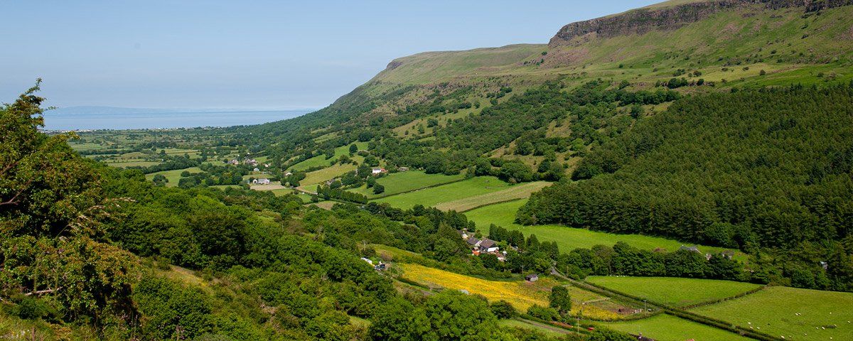
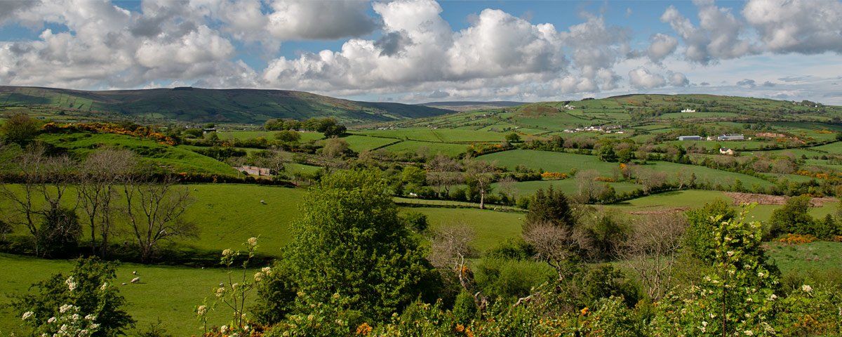
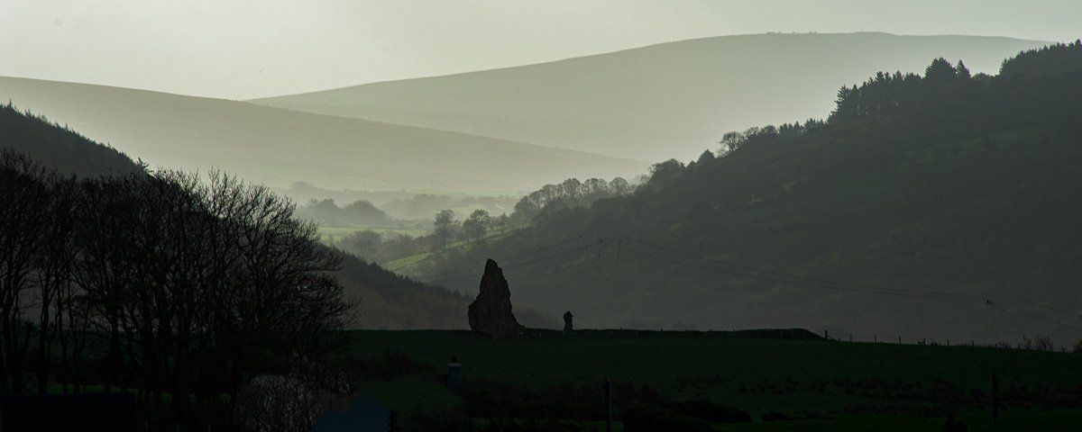
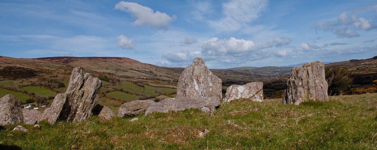
A beautiful mystical glen that stretches from Aghan mountain and sweeps down between Tievebulliagh and Crocknacreeva to merge into Glencorp, gorgeous in the summer when the blooms of red fuchsia line the road. The most famous spot in the glen would have to be the court cairn known as Ossian's (Oisin) grave, the site is Neolithic in origin and reputed to have been where Ossian, the son of Finn MacCool was buried. The story tells of Oisin marrying Niamh and going to live in the mythical land of Tir na nOg, after a few years he became homesick and wanted to return to visit his family and home. Niamh agreed that he should return on her white horse, the same horse that carried them both to Tir na nOg on.

Photo of Glenaan by Art Ward ©
Before leaving she told him never to touch the ground while he was away from Tir na nOg or he would die, on reaching Glenaan he discovered that 300 years had passed by and all his family and friends were gone. His father Finn was remembered only in local folklore. On seeing that no-one was left he turned to go back to Tir na nOg, as he made his way down the glen he came upon some men trying to move a large boulder, he stopped to help but as he turned in his saddle the belt holding it broke and he fell to the ground, instantly aged and died. The men who witnessed this were mystified by what had happened and buried him at the spot where he fell. The court cairn is at Lubitavish, years ago the Department of the Environment had a sign on the main coast pointing to Ossians Grave, this has now gone. The site is on the left about 1 km off the Causeway Coastal Route. A lane goes through a private farmyard and the court cairn is on private farmlands.
Photo of Glenaan by Art Ward ©
I am not sure what the access is so its better to ask permission.  In the same field as the court cairn is another small beehive-like stone cairn to the memory of John Hewitt. He wrote the following poem about Ossians Grave. We stood and pondered on the stones whose plan displays their pattern still; the small blunt arc, and, sill by sill, the pockets stripped of shards and bones. The legend has it, Ossian lies beneath this landmark on the hill, asleep till Fionn and Oscar rise to summon his old bardic skill in hosting their last enterprise. This, stricter scholarship denies, declares this megalithic form millennia older than his time - if such lived ever, out of rime - was shaped beneath Sardinian skies, was coasted around the capes of Spain, brought here through black Biscayan storm, to keep men's hearts in mind of home and its tall Sun God, wise and warm, across the walls of toppling foam, against this twilight and the rain.
Photo of Glenaan by Art Ward ©
I cannot tell; would ask no proof; let either story stand for true, as heart or head shall rule. Enough that, our long meditation done, as we paced down the broken lane by the dark hillside's holly trees, a great white horse with lifted knees came stepping past us, and we knew his rider was no tinker's son.
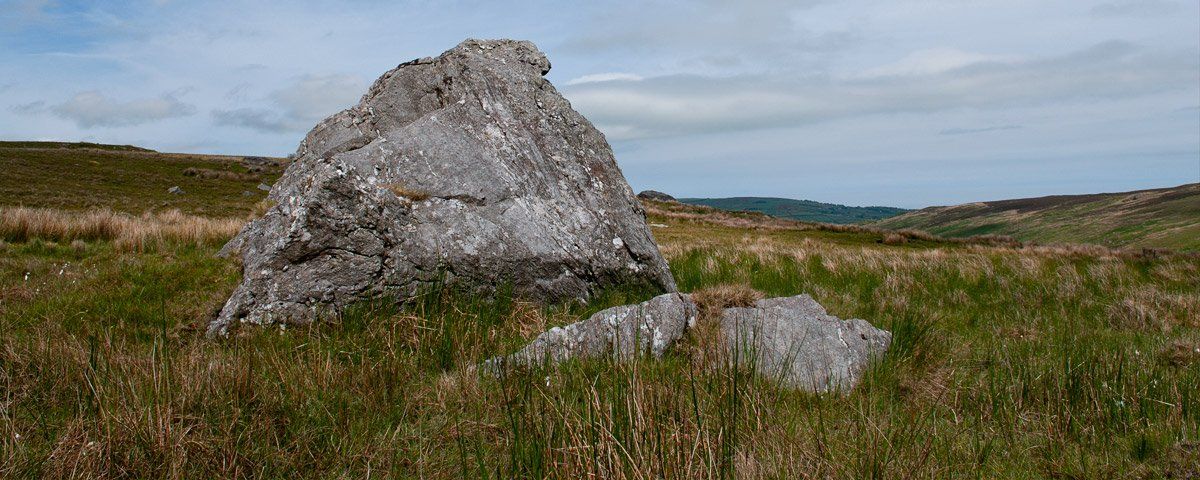
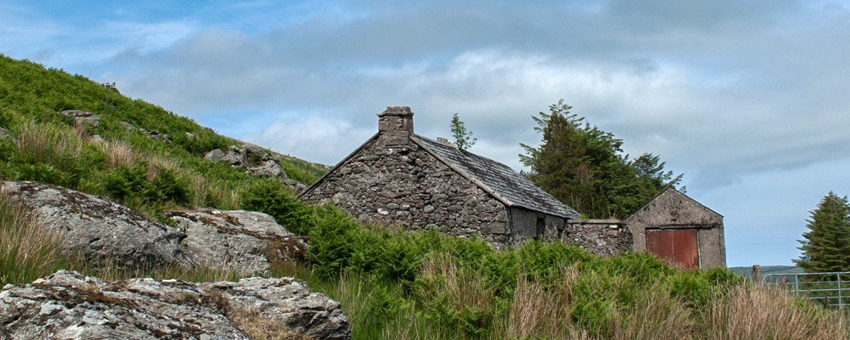
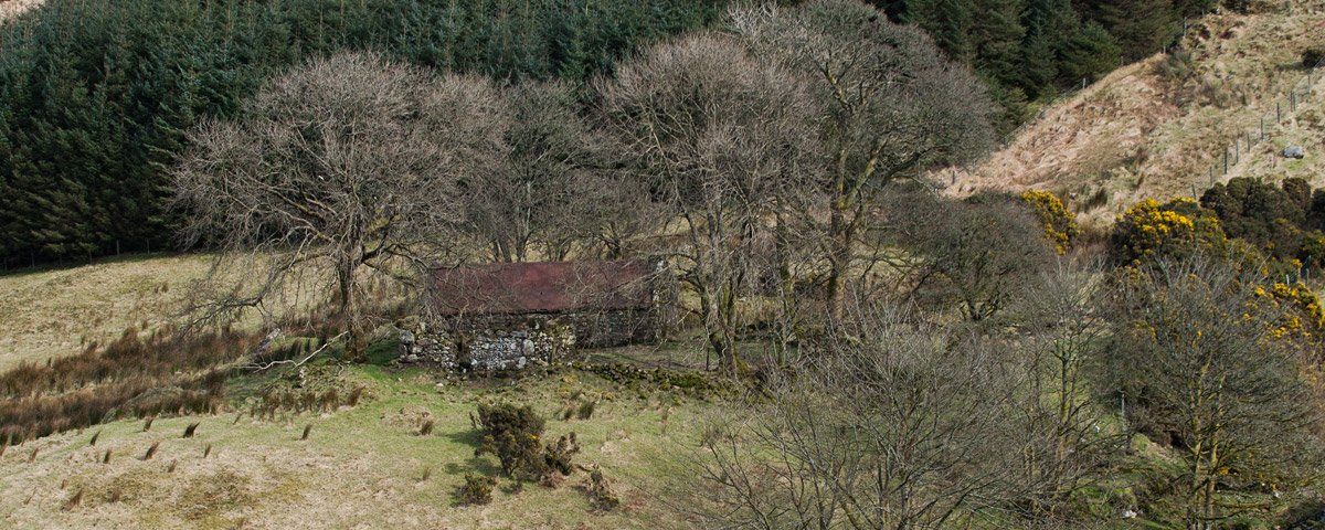
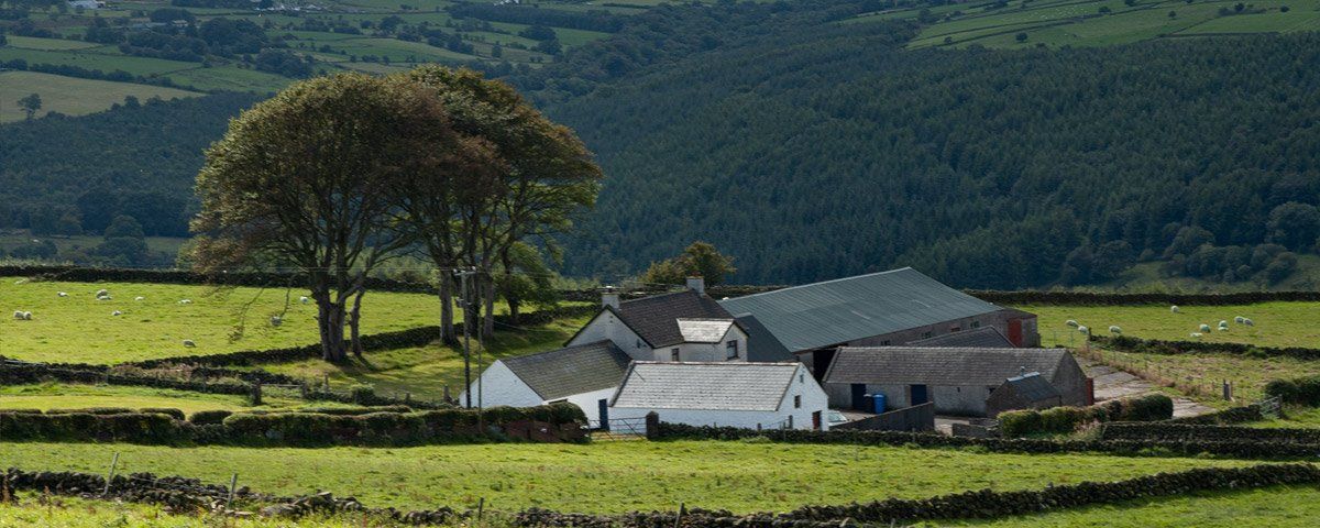
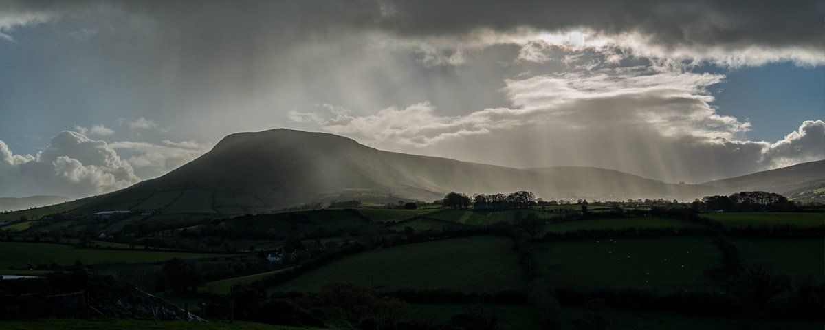
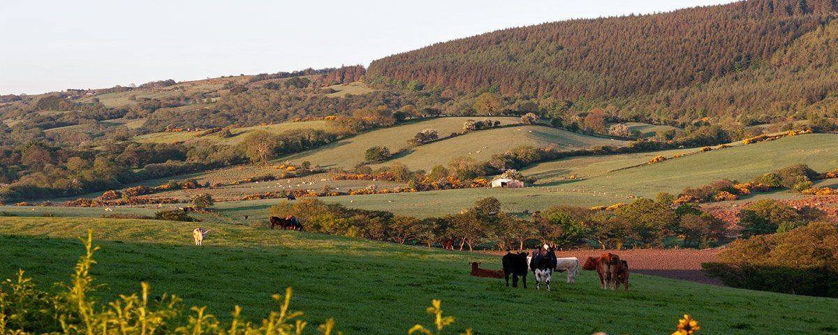
Tievebulliagh is another unique site, one of two in the north Antrim, the other one is on Rathlin Island, where porcellanite axe production and distribution took place from the Neolithic period. Examples of axes from here have been found in many parts of England, Scotland, Wales and Ireland. The cairn on top of Tievebulliagh dates to the bronze age. All along the glen, you will see the ruins of old cottages and farmsteads long-abandoned including the small hamlet or clachan of Knockbann which looks out across Glenaan and Glencorp.
Glendun - Glen of the river Dun
Photo of Glendun by Art Ward ©
A beautiful and varied glen which descents from the now farmed forest and tundra-like slopes of Slieveanorra mountain down past deciduous and evergreen woodlands to Cushendun. The mountain of Crocknacreeva and Gruig Top form one side and Crocknamoyle and Crockaneel the other. A small road follows the entire length of the glen from Cushendun to Bryvore bridge where it joins with the Glenaan Road. A Scenic Drive takes in both glens with the drive either rejoining the main Causeway Coastal Route at the Glendun Viaduct or continuing on under the viaduct before eventually arriving in the small picturesque village of Cuhsendun. The most unique feature of Glendun is the Charles Lanyon bridge which was completed﷯ in 1839 when he was 26 years old, Lanyon would go on to become one of Ulster's best-known architects with some exceptional buildings to his credit.
Photo of Glendun by Art Ward ©
The Glendun Bridge is referred to as the viaduct due to its  'classic' design which is modelled on similar architecture,  it forms  three large arches, one over the glen road and the other the river Dun.  The stone for the bridge was quarried in the townland of the Layd and brought into Cushendun harbour by boat then by horse and cart to the construction site. The bridge was built as part of William Bald's  Antrim Coast Road which started in 1832.  A road turns off at the bridge which takes you down to join the glen road that forms part of the Glendun/Glenaan Scenic Drive which can be joined in Cushendun or on the main Causeway Coastal Route at Glenaan.  The road  through Glendun is narrow, so if you do venture up or down it take care and drive slowly as it is a rural road used by both farm vehicles and animals, sheep would be quite common to see along the roadside.
Photo of Glendun by Art Ward ©
It was Glendun that became a decisive factor in the McDonnell's defeat of the O'Neill's, McQuillans and two companies of English soldiers under the command of Captain Thomas Chatterton that had been sent from Dublin. The Battle of Orra in 1583 was the decisive battle in the power struggle between the clans during the 1500s. Under the cover of darkness and with superior local knowledge Sorley Boy McDonnell brought his force of lightly armed men across from Ballycastle and down through a steep valley into Glendun where he followed the river up to Slievanorra, passing below the sightlines of his enemies camps. During the night he strategically placed his camp and cut rushes which lay on the ground to disguise the bogland between him and one of his enemies camps, with the trap set he waited for daylight.
Photo of Glendun by Art Ward ©
As morning broke his camp was revealed in what appeared to be a vulnerable position, the decision was made by O'Neill and Chatterson to send the heavy cavalry in to defeat the lightly armed McDonnells. They charged down the slope and straight into the trap set during the night, what appeared like solid ground gave way under the horses and whole company became stuck in bogland to their demise as the McDonnells moved in to kill them. This effectively levelled the balance, when the muskets failed to fire in the damp morning air of the mountain the opposing forces fate was sealed and they retreated, Hugh O'Neill was killed on Slievanorra, Rory McQuillan and Captain Chatterton fled the scene and were hunted down and killed, Rory McQuillan was found on the crannog at Lissanoure and Captain Chatterson was caught in the glen.
Glenshesk - Glen of the Rushes
Photo of Glenshesk by Art Ward ©
A steep-sided glen on the eastern flank of Knocklayd mountain, it commands some of the best views of Rathin Island from the high road which stretches the whole length of the Glen from Ballycastle to Breen Bridge. The same road forms part of the excellent Moyle Way from Ballycastle to Glenariff. The lower road follows the far side of the glen from Ballycastle crossing back over the river at the impressive high arch of the Glenshesk bridge. The 15th-century Friary of Bonamargie is situated at the foot of the glen while a little way up at Drumeeny is the site of an ancient church ruin which is attributed to Saint Gobban, the legendary north Antrim builder said to have been responsible for the construction of Templastragh (Temple of the Flame), some believe St.Goban or Gobain originated from Glenshesk.
Photo of Glenshesk by Art Ward ©
Glenshesk is scattered with the ruins of cottages set in idyllic landscapes that echo the hardship of existences in days gone by, some of these ruins date back to the 1700s and are unique in themselves as examples of our heritage. The glen has also seen the coming and going of clans and their endless battles, ransackings and parleying. Close to where the glen starts to form you will find the burial place of Hugh MacPhelim O'Neill who was killed at the Battle of Orra in 1583 when the combined forces of the O'Neill's, McQuillan's and English Cavalry were defeated by the McDonnell's and their Irish allies.
Glentaisie - Glen of Taisie
Photo of Glentaisie by Art Ward ©
The glen is named after Taisie, who was the daughter of a Rathlin Chieftain. She married Congal, son of the King of Dalriada. Congal received the glen and other lands along the coast as a wedding gift from her father, he would later succeed his father to become king. Taisie's father also built a fort for the couple in Glentaisie, the photo below is the mound or a drumlin known as 'The Fort' and reputed to be where they lived after their marriage. Small hills and drumlins cover the length of this glacial formed glen as its sweeps down the western flank of Knocklayd to Ballycastle. It has many interesting features which includes the remains of two motte forts, a rath, several standing stones and remnants of the narrow gauge railway which ran from Ballymoney to Ballycastle.
Photo of Glentaisie by Art Ward ©
The railway opened in 1880 and its small light green engines and dark brown coaches served the district until it closed in the 1950s. The entire project was tendered for under £40,000 and included many bridges and even a small tunnel near Capecastle. You can still find traces of the old railway line though the tracks have gone, in recent years there have been proposals put forward to reinstate part of it as a walk and cycle route. It was at the foot of Glentaisie near Ramoan that the MacDonnells regrouped their army before facing the O'Neill's at the 'Battle of Glentaisie' on May 2nd,1565. James MacDonnell had arrived from Scotland with reinforcements to aid Sorley Boy MacDonnell in his struggle with the O'Neill's who had forced him to retreat to Ballycastle after being defeated in the Glens.
Photo of Glentaisie by Art Ward ©
The battle resulted in the defeat of the MacDonnells and the death of Sorley's brother Angus, his other brother James died a few days later from wounds inflicted on the battlefield. If you want to travel through Glentaisie first, drive to the Hillhead on the main road out of Ballycastle to Coleraine. Next to the Hillhead Garage, you will find a road leading off to the left down into Glentaisie. You can then follow this road through the glen to St. Patricks Church near Armoy. At St Patrick's you have a choice of either turning left for Glenshesk and Breen Wood or right for a short detour into Armoy and the Dark Hedges. If you go into Armoy then retrace your route back to St Patricks for Glenshesk. Breen Wood is a remnant of an ancient oak forest that would have once covered most of the glen, it is now a nature reserve, nice for a walk with lots of lichens and wildlife.
Photo of Glentaisie by Art Ward ©
Opposite Breen Wood entrance you can alternatively follow the high road back to Ballycastle along the eastern side of Knocklayd above the glen, this road has some panoramic views to Rathin Island or follow the designated scenic drive through Glenshesk, it is worth seeing both routes. Both end up at the same junction in Ballycastle. The road along the mountainside is narrower but will give you get great views and it also goes past a car park area where people park and set out to climb to the top of Knocklayd, if you do that make sure you have the right gear and footwear and allow several hours. Remember to lock your car and remove or hide all valuables from view as even here we have the odd moron looking for opportunities to steal.
Share by: