Torr Head Scenic Route'
Length of Drive
14 miles / 22 kilometers
Road Description
The road is two way with unlined sections, it is windy and in places narrow with steep climbs, the road down to Torr Head car park is single lane. The roads are all working roads with farm machinery, sheep and oncoming vehicles. It is not suitable ffor Coaches, RVs and mini-coaches. The route is signposted at Cushendun and Ballyvoy. If you take the Torr Scenic Route you will loose 10 miles off the Causeway Coastal Route as it climbs over the mountain from Glendun Viaduct and passes Loughareema (The Vanishing Lake) and Ballypatrick Forest, I suggest looping back to see the view over the glens from the mountain top and also to visit Loughareema.
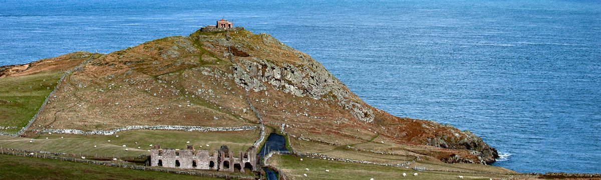
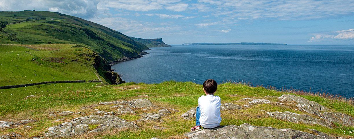
The Ulster Way and International Appalachian Way follows the road which passes the access lanes to Fair Head and Murlough Bay. From Murlough the Torr Head Scenic Route climbs to Greenamore Mountain which has spectacular views over Torr Head and across to the Mull of Kintyre, Scotland. The old ruined buildings below Torr Head were once customs house accommodation and the building on the top of the headland, a lookout station - in the late 1800s like at Malin Head, this was a semaphore signalling station that recorded the passage of transatlantic ships and relayed the information to Lloyds of London as well as to the port of destination, it is one of the first places that wireless telegraphy developed by Marconi was installed.
I have to point out that parking here can frequently turn into a nightmare during peak times as the car park which you can see in the first image above is a 'cul de sac' with inadequate turning facilities. If you come off-season then it is fine but you will still on occasions encounter larger vehicles with passengers who have ignored the 'not suitable signs'. The tides around Torr Head are treacherous - on a still day when a flood tide is running you can hear it sounding like the roar of a fast-flowing river. The small harbour and old salmon fishery of Port-aleen lies on the east side of the headland, nestled close to the shore and sheltered from prevailing winds. The roads around Torr in summer are lined with Flowering Currant (Ribes sanguineum) which was planted intentionally as hedgerows.
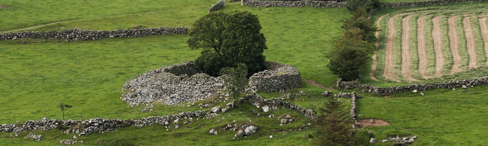
This native North American plant gives a wonderful display of colour enhancing the already stunning natural landscape. The road from Torr climbs up to Green Hill and then descends steeply into Loughan which overlooks Loughan Bay, scattered in the landscape you will see the remains of small cottages whose occupants left and emigrated over a century ago. It always leaves me wondering in thought as to how they managed to scratch an existence and raise families in such a wild, exposed landscape that up until the late 1800s was almost inaccessible. From Loughan and Coolranny (Culranny) the road ascends and takes you round Carnaneigh Mountain where it descends into Tornamoney Valley - as you descend, on the far side of the valley you will see Altagore Cashel.
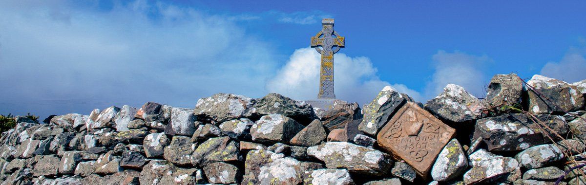
The walls of this stone fort are still three metres high and show evidence of internal stairs which accessed a terrace - cashel's like these were built in Ireland between 500BC and 1000AD - this one is believed to date to the early Christian period. From here the route finally descends into Cushendun past a cairn erected in 1908 to Shane O'Neill, and further down the road is the ruin of Carra Castle which he at one time owned. The Torr Head Scenic Route is extremely beautiful but you should take extra caution as it is a minor road which in places is extremely narrow and winding with some steep inclines. Many wing mirrors have been lost on this road due to people not taking care.
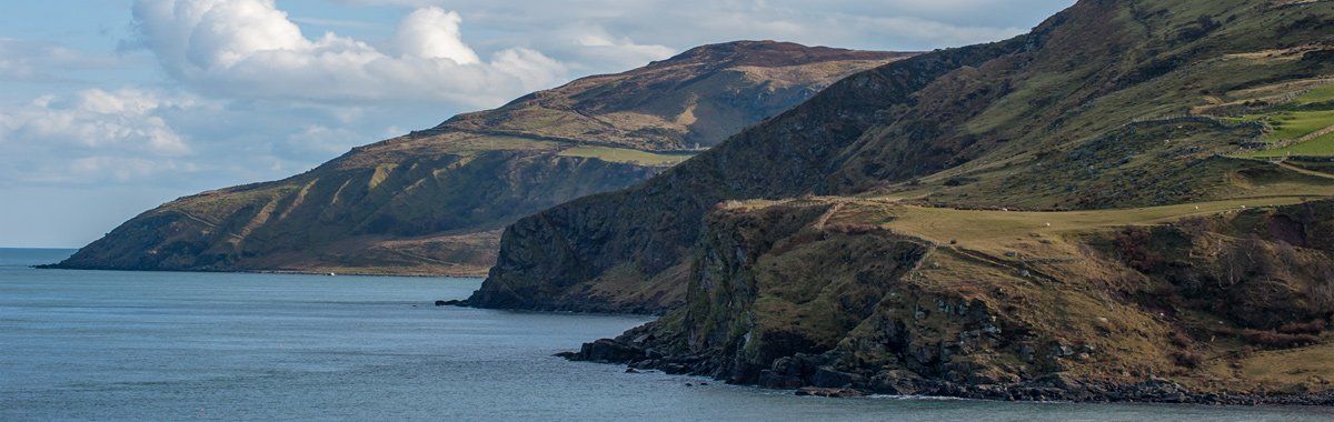
For me, apart from the wildness of the landscape, thhe highlights are the spectacular views across the North Channel to Scotland and the Mull of Kintyre, It is a drive-through beautiful, wild landscape full of sheep and old ruined homesteads. Remember if you take the Torr Head Scenic Route and rejoin the Causeway Coastal Route you will miss Glendun and the famous Glendun Viaduct bridge and also Loughareema, the vanishing lake which lies on top of the mountain road plus on a clear day a view over five glens, if you want to see these cut back as they are worth it.